To help navigate through the information contained here,
you can read the information in its entirety by scrolling through the page,
or use the choices below to go directly to the section of interest.
Backcountry Map & Camping Information (Use Areas with Boundaries): Click Here
Single Page Map with a More Expansive View from Bob Ribokas's "Grand Canyon Explorer" Site:Click Here
There are two other map offerings in a larger format printed on weather-resistant paper:
Most Comprehensive: The "National Geographic Trails Illustrated Grand Canyon Outdoor Recreation Map" - Most of the Use Areas are represented
More Compact: The "SkyTerrain.com Grand Canyon National Park Trails Map, by Ken Schulte - Does not include Use Areas in the more peripheral outlying portions of the Park
These and other key maps providing full Canyon coverage are available for purchase through this portal:
The TOPO products below allow you to create your own trip specific maps and access the TOPO based maps included in the trail descriptions portion of the "Trips" page.
Other Grand Canyon maps of interest are available for purchase through this portal:
The traffic that the Corridor, Threshold and even some of the Primitive zone trails receive, make them pretty distinct and generally easy to follow.
Corridor and some Threshold trails often have strategically located signage at main trail junctions to help you stay on track. These luxuries are nonexistent on Primitive and Wild zone trails.
Difficulties often begin when the trail gets into hard-packed terrain, crosses solid rock or descends into canyon bottoms and washes.
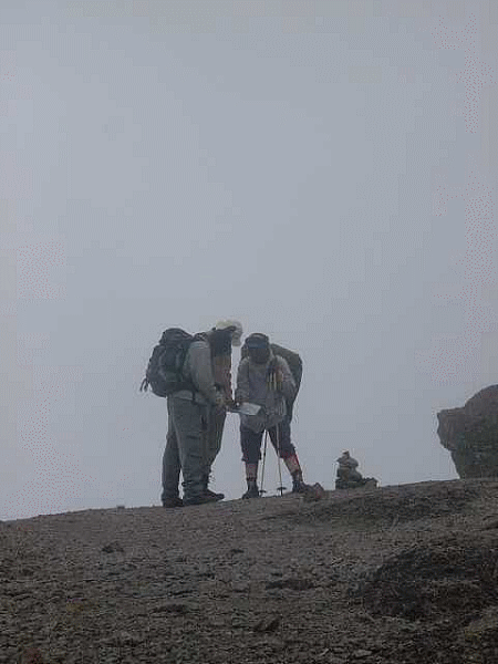
Cairns, stacked stones used to mark trails, are commonly present to provide assistance in locating the trail in areas where it grows sketchy. But remember the old adage, two rocks do not a cairn make. Look for at least 3 rocks (technically referred to as a “duck”) stacked atop one another in order to consider it a cairn.
Washes: Take care when the trail heads into washes, their natural flow and gravel bottom which at times does not seem to hold a boot-print too well can result in missing a cairn or obvious trail exit from the wash.
If you think you’ve lost the trail:
Look up to the higher ground in your immediate area to see if you can spot it.
If that fails, stop and back-track, retracing your route until you pick up the trail again.
It is common on most trails to come to forks that are not always described in the trail guides.
Overlook Spur Trails: Most often these head to an overlook. Sometimes they loop back to join the main trail while other times you will need to backtrack to return to your trail.
“Pit Stop” Trails: Similar to an overlook spur trail, but often a bit sketchier. They often dead-end at a cliff-face or behind a boulder and may or may not have some amount of toilet paper undergoing some stage of biodegradation. These almost always require doubling back to get back on to your trail.
As you approach an undocumented fork, the first thing to do is to look for a line of rocks that may have been placed across the path of one of the forks. Sometimes rocks or branches are used to mark an “X.” These are other hikers’ way of warning you that the fork probably goes somewhere you’d rather not waste your time on.
These trails are the result of the comings and goings of the local inhabitants; mostly mule deer, skunks, coyotes, gray fox, ringtails, bobcats, and the occasional desert bighorn sheep.
These can sometimes present a confusing choice at a fork in your trail, or when you’ve accidentally gone off trail and are trying to get back on. They tend to be sketchier than a backcountry trail. But, sometimes more remote backcountry trails ARE game trails, or started out that way.
There is no sure-fire advice to give when you’re looking for your trail and come across something that could either be your trail or a game trail. The best thing to do is use common sense, keep your eyes open, and extend your vision more broadly than 20 feet immediately around you.
Look up and down the adjacent slopes to see if you can pick up the outline of the trail somewhere more distant. This takes some practice, but gets easier with time. You can practice while on the main trail. Scan ahead or your current position looking to pick up sight of the track as it winds it way up or down the Canyon.
Look for tracks from other hikers that continue consistently for a distance. Those tracks could mean that it’s the main trail, but sometimes those tracks are there for the same reason you’ve found yourself there… Those hikers too have gotten off the trail.
Game trails can be a boon when hiking in remote areas and those trails are heading in the direction you want to go. The animals that create these trails have a knack for figuring out the most energy-efficient route across the terrain. Studies have shown that despite what might appear to be energy inefficient ups and downs, the game trail typically turns out to be the most efficient alternative… assuming that it’s going where you want to go.
If you find yourself on a trail and start thinking that taking an obvious short-cut might shorten your day, think again.
The bottom-line is that if you’re on a trail, there are no short-cuts. Stay on the trail.
If you’re thinking that you can shave some time by heading straight down-hill and cutting across switchbacks, forget about that as well. The switchbacks are there to help protect the trail and terrain surrounding it from erosion. This is the reason that Park rules prohibit the short-cutting of switchbacks.
A very high percentage of search and rescue operations and fatalities in the Canyon begin with backcountry travelers seeking a short-cut.
Simply said, don’t try to find short-cuts in the Canyon, unless you are highly experienced in off-trail navigation. Off-trail navigation is very different from taking a short-cut. It would more appropriately be called, "off-trail travel" or "bush-whacking."
Bush-whacking is essentially off-trail travel that is facilitated by the application of basic navigation skills (i.e., map, compass and sometimes a GPS (Global Positioning System) unit.
Off-trail travel in the Canyon should not be undertaken unless you are very familiar with map reading and the use of a compass.
A GPS, while a handy tool, is a poor substitute for map and compass skills.
A trip planned with bush-whacking as a component needs to be very well planned.
An intimate familiarity with the topographic maps defining your area of travel and the key landmarks that will be encountered along the way is vital.
Distance calculations and travel time need to be estimated taking into consideration the nature of the terrain.
Off-trail travel can add significantly to the amount of time it takes to travel a similar distance by trail. If boulder fields or rock hopping down a wash are expected. Plan on doubling or tripling your normal travel time.
Your plan should include the use of a compass course log to record headings and coordinates during your travel. This will not only serve to keep you on course, but also can come in handy if you need to back-track should your route encounter an unplanned obstacle that cannot be circumvented.
Should scrambling or climbing be involved, always be cognizant that the down-climb is usually much more difficult than the up-climb. Don't end up stranding yourself by over-estimating your ability to down-climb.
The plan must also include the identification of primary and back-up water sources. These must be marked on your map and include as much location information as is available to provide assistance in locating them in the field.
Frequent stops to check your map against key landmarks and to record compass headings in your log is critical to ensure that your stay found.
In certain instances it may be helpful to “breadcrumb” your path of travel by building a series of small cairns along the way. Always remember to remove them later when you reverse course.
A number of excellent resources are available to help you develop map, compass and GPS skills. It is recommended that you learn and become proficient at them outside of the Canyon.
 WildGeeseAdventures.com
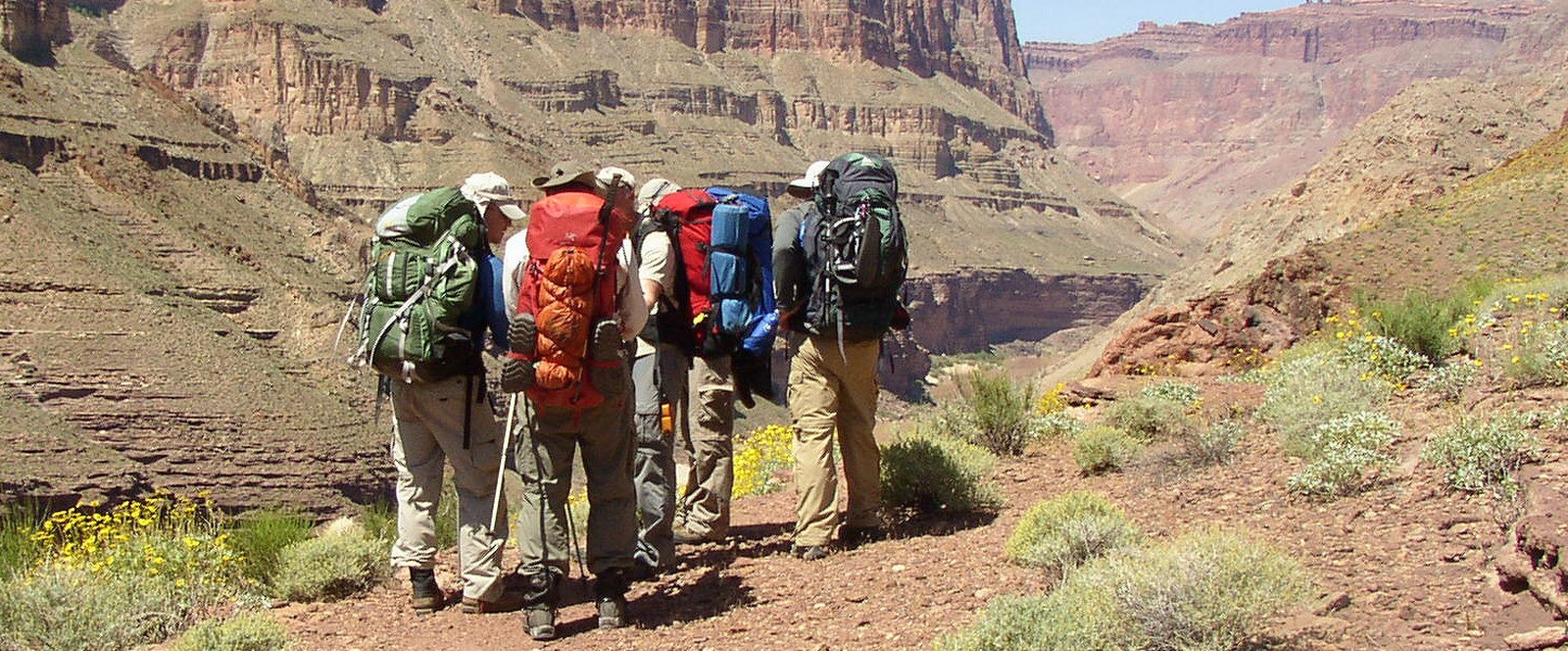
 The traffic that the Corridor, Threshold and even some of the Primitive zone trails receive, make them pretty distinct and generally easy to follow.